Dagupan City (Dagupan City)
 |
Located on the Lingayen Gulf on the northwest-central part of the island of Luzon, Dagupan is a major commercial and financial center north of Manila. Also, the city is one of the centers of modern medical services, education, media and communication in North-Central Luzon. The city is situated within the fertile Agno River Valley and is in turn a part of the larger Central Luzon plain.
The city is among the top producers of milkfish (locally known as bangus) in the province. From 2001 to 2003, Dagupan's milkfish production totaled to 35,560.1 metric tons (MT), contributing 16.8 percent to the total provincial production. Of its total production in the past three years, 78.5 percent grew in fish pens/cages while the rest grew in brackish water fishponds.
Dagupan is administratively and politically independent from the provincial government of Pangasinan and is only represented by the province's legislative district.
Dagupan is one of the proposed metropolitan area in the Philippines. Metro Dagupan is proposed to include the independent component city of Dagupan, as well as the towns of Binmaley, Calasiao, Lingayen, Manaoag, Mangaldan, Mapandan, San Fabian, San Jacinto, and Santa Barbara.
The city's name was derived from the local Pangasinan word pandaragupan, meaning "gathering place" as the city has been a regional market center for centuries.
Map - Dagupan City (Dagupan City)
Map


Country - Philippines
 |
 |
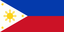
| Flag of the Philippines | |
Negritos, some of the archipelago's earliest inhabitants, were followed by successive waves of Austronesian peoples. Adoption of animism, Hinduism and Islam established island-kingdoms called Kedatuan, Rajahnates, and Sultanates. The arrival of Ferdinand Magellan, a Portuguese explorer leading a fleet for Spain, marked the beginning of Spanish colonization. In 1543, Spanish explorer Ruy López de Villalobos named the archipelago Las Islas Filipinas in honor of Philip II of Spain. Spanish settlement through Mexico, beginning in 1565, led to the Philippines becoming ruled by the Spanish Empire for more than 300 years. During this time, Catholicism became the dominant religion, and Manila became the western hub of trans-Pacific trade. In 1896, the Philippine Revolution began, which then became entwined with the 1898 Spanish–American War. Spain ceded the territory to the United States, while Filipino revolutionaries declared the First Philippine Republic. The ensuing Philippine–American War ended with the United States establishing control over the territory, which they maintained until the Japanese invasion of the islands during World War II. Following liberation, the Philippines became independent in 1946. Since then, the unitary sovereign state has often had a tumultuous experience with democracy, which included the overthrow of a decades-long dictatorship by a nonviolent revolution.
Currency / Language
| ISO | Currency | Symbol | Significant figures |
|---|---|---|---|
| PHP | Philippine peso | ₱ | 2 |
| ISO | Language |
|---|---|
| EN | English language |
| TL | Tagalog language |